Datasets
Standard Dataset

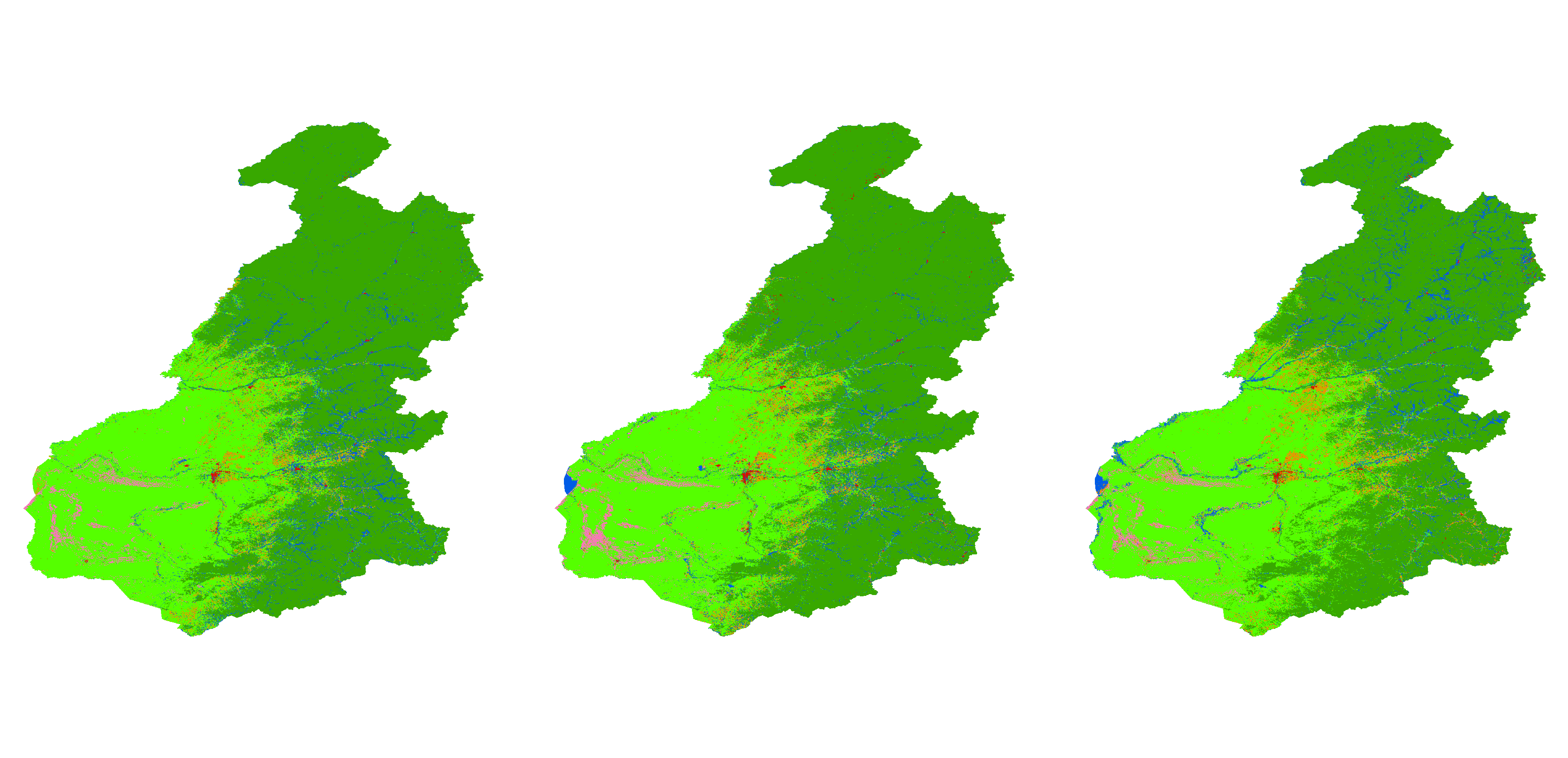
Land use mapping for the forest-steppe ecotone in the Greater Khingan Mountains, 2019 to 2021
- Citation Author(s):
- Submitted by:
- Ruilin Wang
- Last updated:
- Thu, 07/20/2023 - 03:47
- DOI:
- 10.21227/gqgz-x889
- Data Format:
- License:
 132 Views
- Categories:
- Keywords:
Abstract
Generating accurate thematic land use maps is importance in ecologically vulnerable regions, especially considering the challenges associated with extracting the forest-steppe ecotone and its associated uncertainties and high error rates. By employing the Principal Component Analysis (PCA) method to integrate Sentinel-1 and Sentinel-2 imagery, high-resolution (10 meters) land use cover products were generated for the forest-steppe ecotone of the Greater Khingan Mountains from 2019 to 2021. The classification process utilized prior knowledge and an object-oriented classification-based approach. The main objective was to evaluate the accuracy improvement achieved through the integration of multi-source remote sensing data, while highlighting the advantages of the object-based classification method and comparing it with existing products. The results demonstrated a significant enhancement in classification accuracy, surpassing the accuracy obtained from individual Sentinel-1 or Sentinel-2 images. Furthermore, the object-oriented analysis approach yielded classification results that more accurately represented real-world land cover conditions while reducing salt-and-pepper noise. The research also showcased superior accuracy in delineating complex riverine wetlands, outperforming other existing land use/land cover (LULC) datasets. The generated 10m land use products provide valuable information for supporting sustainable development, effective management, and ecological assessment and conservation efforts in the Greater Khingan Mountains.
1 cropland
2 forest
3 grassland
4 water
5 building
6 unused


