GNSS
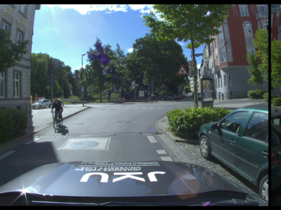
(Under Construction) The IAMCV Dataset was acquired as part of the FWF Austrian Science Fund-funded "Interaction of Autonomous and Manually-Controlled Vehicles" project. It is primarily centered on inter-vehicle interactions and captures a wide range of road scenes in different locations across Germany, including roundabouts, intersections, and highways. These locations were carefully selected to encompass various traffic scenarios, representative of both urban and rural environments.
- Categories:
 184 Views
Interference signals degrade the performance of a global navigation satellite system (GNSS) receiver. Detection and classification of these interference signals allow better situational awareness and facilitate appropriate countermeasures. However, classification is challenging and processing-intensive, especially in severe multipath environments. This dataset is the result of a proposal for a low-resource interference detection and classification approach that combines conventional statistical signal processing approaches with machine learning (ML).
- Categories:
285 Views
Three raw (i.e., In-Phase and Quadrature data with a software radio, and observation files) GNSS dataset were recorded using a LabSat Version 3 inside of the West Virginia University greenhouse and two outside recordings were also made to provide a quality reference and comparison. The outdoor location had to be an ideal location for satellite signal reception and the indoor location was a greenhouse room where satellite visibility was limited, susceptible to attenuation, occlusion and multipath.
- Categories:
625 Views