Image Processing

The "ShrimpView: A Versatile Dataset for Shrimp Detection and Recognition" is a meticulously curated collection of 10,000 samples (each with 11 attributes) designed to facilitate the training of deep learning models for shrimp detection and classification. Each sample in this dataset is associated with an image and accompanied by 11 categorical attributes.
- Categories:
 454 Views
Light-matter interactions within indoor environments are significantly depolarizing. Nonetheless, the relatively small polarization attributes are informative. To make use of this information, polarized-BRDF (pBRDF) models for common indoor materials are sought. Fresnel reflection and diffuse partial polarization are popular terms in pBRDF models, but the relative contribution of each is highly material-dependent and changes based on scattering geometry and albedo.
- Categories:
116 Views
Recognizing and categorizing banknotes is a crucial task, especially for individuals with visual impairments. It plays a vital role in assisting them with everyday financial transactions, such as making purchases or accessing their workplaces or educational institutions. The primary objectives for creating this dataset were as follows:
- Categories:
233 Views
This dataset contains video-clips of five volunteers developing daily life activities. Each video-clip is recorded with a Far InfraRed (FIR) camera and includes an associated file which contains the three-dimensional and two-dimensional coordinates of the main body joints in each frame of the clip. This way, it is possible to train human pose estimation networks using FIR imagery.
- Categories:
238 Views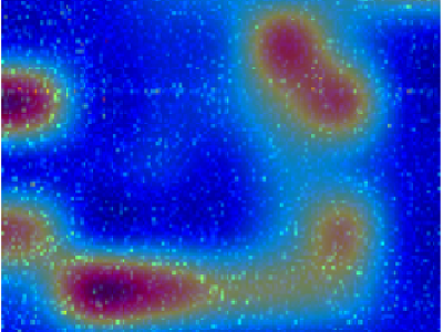
This dataset contains the Supplementary Information of the article "Discovering Mathematical Patterns Behind HIV-1 Genetic Recombination: a new methodology to identify viral features" (Manuscript DOI: 10.1109/ACCESS.2023.3311752).
- Categories:
259 Views
SYPHAXAR dataset is a dataset for Arabic text detection in the wild. It was collected from Tunisia in “Sfax” city, the second largest Tunisian city after the capital. A total of 3078 images were gathered through manual collection one by one, with each image energizing text detection challenges in nature according to real existing complexity of 15 different routes along with ring roads, intersections and roundabouts. These annotated images consist of more than 31000 objects, each of which is enclosed within a bounding box.
- Categories:
205 Views
Point cloud streaming has recently attracted research attention as it has the potential to provide six degrees of freedom movement, which is essential for truly immersive media. The transmission of point clouds requires high-bandwidth connections, and adaptive streaming is a promising solution to cope with fluctuating bandwidth conditions. Thus, understanding the impact of different factors in adaptive streaming on the Quality of Experience (QoE) becomes fundamental. Point clouds have been evaluated in Virtual Reality (VR), where viewers are completely immersed in a virtual environment.
- Categories:
77 Views
The "Paddy Field Dataset Captured in Palakkad District, Kerala, India" is a comprehensive collection of geospatial and attribute data specifically focused on paddy cultivation within the Palakkad district of the Kerala state in India. This dataset encompasses a wide range of information related to paddy fields, including their spatial distribution, size, crop varieties cultivated, land management practices, and relevant contextual factors. Geographic Information System (GIS) technology has captured accurate geospatial coordinates, enabling precise mapping and analysis.
- Categories:
420 Views
The "Paddy Disease Dataset" represents a comprehensive collection of data related to various diseases commonly found in paddy crops. Paddy, or rice, is a staple crop crucial for global food security. However, paddy crops are susceptible to a range of diseases that can significantly impact yield and quality. This dataset encompasses a diverse array of disease-related information, including disease types, symptoms, geographical distribution, severity levels, and potential management strategies.
- Categories:
266 Views
We used Sentinel-2 images to create the dataset In order to estimate sequestered carbon in the above-ground forest Biomass. Moreover, fieldwork was completed to gather related forest biomass volume. The clipped image has a size of 1115 × 955 pixels and consists of bands 3, 4, and 8, which correspond to green, red, and near-infrared.
- Categories:
665 Views